Geo-historical database of the Rhine

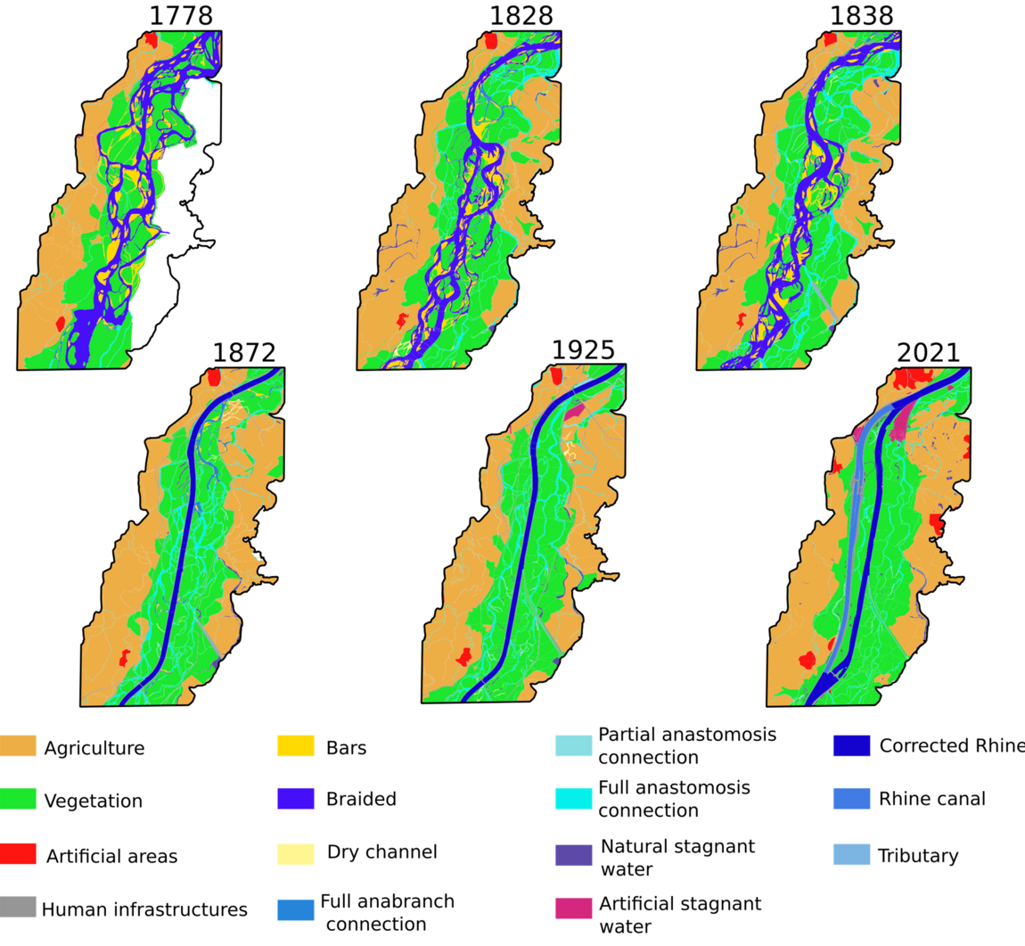
The "Plan Rhin Vivant" aims at restoring as much as possible the hydromorphological and ecological functioning of the Upper Rhine as well as the related ecosystem services. For this, it is necessary that the managers have a robust knowledge of (i) the functioning of the river before its systematic anthropization from the middle of the 19th century (ii) and of its temporal trajectory induced by the three phases of development, and this on the entire Basel-Lauterbourg linear. This study of unprecedented scope is largely based on the quantitative diachronic study of old maps interpreted in terms of aquatic and riparian habitat types (Eschbach et al., 2018; Arnaud et al., 2019; Schmitt et al., 2019; Chardon et al., 2022). This study should help guide managers towards operational choices that maximize the benefits of restorations, particularly in terms of hydromorphological and alluvial hydro-ecological functionality, biodiversity and ecosystem services, efficiency (cost/benefit ratio), adaptation of environments to climate change and sustainability. The results will be available online in the form of maps (Web-GIS).
SOME PUBLICATIONS
Chardon, V., Herrault, P. A., Staentzel, C., Skupinski, G., Finance, O., Wantzen, K. M., & Schmitt, L. (2022). Using transition matrices to assess the spatio‐temporal land cover and ecotone changes in fluvial landscapes from historical planimetric data. Earth Surface Processes and Landforms, 47(11), 2647-2659.
CONTACTS
Pr. Laurent Schmitt PR UNISTRA, Faculté. de Géographie, hydromorphology (resp.) - laurent.schmitt[at]unistra.fr
Valentin Chardon Postdoctoral fellow - valentin.chardon[at]live-cnrs.unistra.fr


