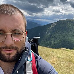
WENGER Romain

Recherches

  • 2019 - 2023 : Thèse de doctorat : « Apport des images Sentinel-1&2 et des méthodes d'apprentissage profond pour la cartographie et le suivi des modes d'occupation des sols »
    Thèse dirigée par A. PUISSANT. UMR 7362 - Laboratoire Image, Ville, Environnement, Université de Strasbourg.

Cursus universitaire

Parcours universitaire

  • 2019 - 2023 : Doctorat « Apport des images Sentinel-1&2 et des méthodes d'apprentissage profond pour la cartographie et le suivi des modes d'occupation des sols ».
  • 2017-2019 : Master « Observation de la Terre et Géomatique ». Université de Strasbourg - Faculté de Géographie.
  • 2016-2017 : Licence 2 Géographie. Université de Strasbourg - Faculté de Géographie.
  • 2015-2016 : Licence pro. « Concepteur développeur en environnement distribué » IUT Robert Schuman - Département Informatique.
  • 2013-2015 : DUT « Informatique ». IUT Robert Schuman - Département Informatique.

Enseignements (heures éq. TD) - 228h

  • 2020-2024 :Intelligence artificielle en Géosciences (niveau : M2 OTG et GeoT, 3A EOST) - 93h
  • 2020-2024 : Programmation niveau 2 (niveau : M1 OTG) - 40h
  • 2022-2024 : Traitement d’images niveau 2 (niveau : M1 OTG) - 45h
  • 2024-2025 : Remise à niveau télédétection (niveau : M1 OTG) - 12h

  • 2024-2025 : Bases physiques en traitement du signal (niveau : M1 OTG) - 18h

  • 2024-2025 : Initiation à la télédétection (niveau : L3 Géographie) - 20h

Encadrements

  • Lucie R. (Master 1 OTG - 2022/2023) : "Phénologie des arbres urbains à partir de données THRS"

  • Romain G. (Master 1 OTG - 2022/2023) : "Suivi phénologique des arbres urbains à partir de séries temporelles d’images satellitaires"

  • Gaelle S. (Master 1 OTG - 2022/2023) : "Evolution intra- et interannuelle des paléopaysages dans les marges sud-ouest du delta du Tibre et de l’Euphrate (Irak)"

  • Baptiste C. (Master 1 AIR Nice - 2023/2024) : "Développement d’une méthodologie basée sur l’intelligence artificielle pour caractériser le climat urbain de l’Eurométropole de Strasbourg et identifier les zones vulnérables aux fortes chaleurs"

  • Marie L. (Ingénieur 3A ENSE3/PHELMA Grenoble - 2023/2024) : "Développement d’une méthodologie basée sur l’apprentissage profond pour la classification des essences d’arbres en ville"

Ecole d'été

  • High Performance and Disruptive Computing in Remote Sensing (HDCRS, https://www.hdc-rs.com/), Reykjavik, Islande. 29 mai au 2 juin 2023. Bourse reçue (Grant) pour cette participation.

Communications scientifiques

Publications

  • [1] Wenger, R., Puissant, A., Weber, J., Idoumghar, L., Forestier, G., (2022) U-Net feature fusion for multi-class semantic segmentation of urban fabrics from Sentinel-2 imagery: an application on Grand Est Region, France, International Journal of Remote Sensing, 43:6, 1983-2011, DOI: 10.1080/01431161.2022.2054295
  • [2] Wenger, R., Puissant, A., Weber, J., Idoumghar, L., and Forestier, G.: MULTISENGE: A MULTIMODAL AND MULTITEMPORAL BENCHMARK DATASET FOR LAND USE/LAND COVER REMOTE SENSING APPLICATIONS, ISPRS Ann. Photogramm. Remote Sens. Spatial Inf. Sci., V-3-2022, 635–640, doi.org/10.5194/isprs-annals-V-3-2022-635-2022, 2022.
  • [3] Wenger, R.; Puissant, A.; Weber, J.; Idoumghar, L.; Forestier, G. Multimodal and Multitemporal Land Use/Land Cover Semantic Segmentation on Sentinel-1 and Sentinel-2 Imagery: An Application on a MultiSenGE Dataset. Remote Sens. 2023, 15, 151. https://doi.org/10.3390/rs15010151
  • [4]  Wenger R., Puissant A., Weber J., Idoumghar I., Forestier G., Exploring inference of a land use and land cover model trained on MultiSenGE dataset, 2023 Joint Urban Remote Sensing Event (JURSE), Heraklion, Greece, 2023, pp. 1-4, doi: 10.1109/JURSE57346.2023.10144156.
  • [5]  Jautzy, T., Freys, P., Chardon, V., Wenger, R., Rixhon, G., Schmitt, L., & Herrault, P. A. (2024). PickShift: A user-friendly Python tool to assess the surficial uncertainties associated with polygons extracted from historical planimetric data. SoftwareX, 27, 101866. https://doi.org/10.1016/j.softx.2024.101866
  • [6]  Wenger R. , Bressant C., Roettele L., Forestier G., and Puissant A., ”Improving Urban Tree Species Classification with High Resolution Satellite Imagery and Machine Learning,” in Proc. IGARSS 2024 - IEEE International Geoscience and Remote Sensing Symposium, Athens, Greece, 2024, pp. 4679–4682

Données

Conférences internationales

  • Puissant A., Michea D., Wenger R., Poterek Q., 2019, Automated Urban Footprint Mapping Over Large Areas: a Method Implemented for Massive Streams of Sentinel-2, Living Planet Symposium, 13-17 May 2019, Milan, Italy, 2019.
  • Wenger R., Michea D., Puissant A., 2021, Automated Urban Footprint Mapping Over Large Areas, EARSeL, 30 March - 1 April 2021, Liège, Belgium, 2021 (Joint Virtual Workshop).
  • Wenger R., Puissant A., Weber J., Idoumghar I., Forestier G., 2022, Multimodal and multitemporal semantic segmentation and scene classification dataset for remote sensing applications, Living Planet Symposium, 23-27 May 2022, Bonn, Germany, 2022. 
  • Wenger R., Puissant A., Weber J., Idoumghar I., Forestier G., 2022, MULTISENGE: A MULTIMODAL AND MULTITEMPORAL BENCHMARK DATASET FOR LAND USE/LAND COVER REMOTE SENSING APPLICATIONS, XXIV ISPRS Congress, 6-10 June 2022, Nice, France.
  • Wenger R., Puissant A., Weber J., Idoumghar I., Forestier G., "Exploring inference of a land use and land cover model trained on MultiSenGE dataset," 2023 Joint Urban Remote Sensing Event (JURSE), Heraklion, Greece, 2023.
  • Wenger R. , Bressant C., Roettele L., Forestier G., and Puissant A., ”Improving Urban Tree Species Classification with High Resolution Satellite Imagery and Machine Learning,” in Proc. IGARSS 2024 - IEEE International Geoscience and Remote Sensing Symposium, Athens, Greece, 2024, pp. 4679–4682


Langues

  • Français (Niveau C2)
  • Anglais (Niveau C1)
  • Allemand (Niveau B1)